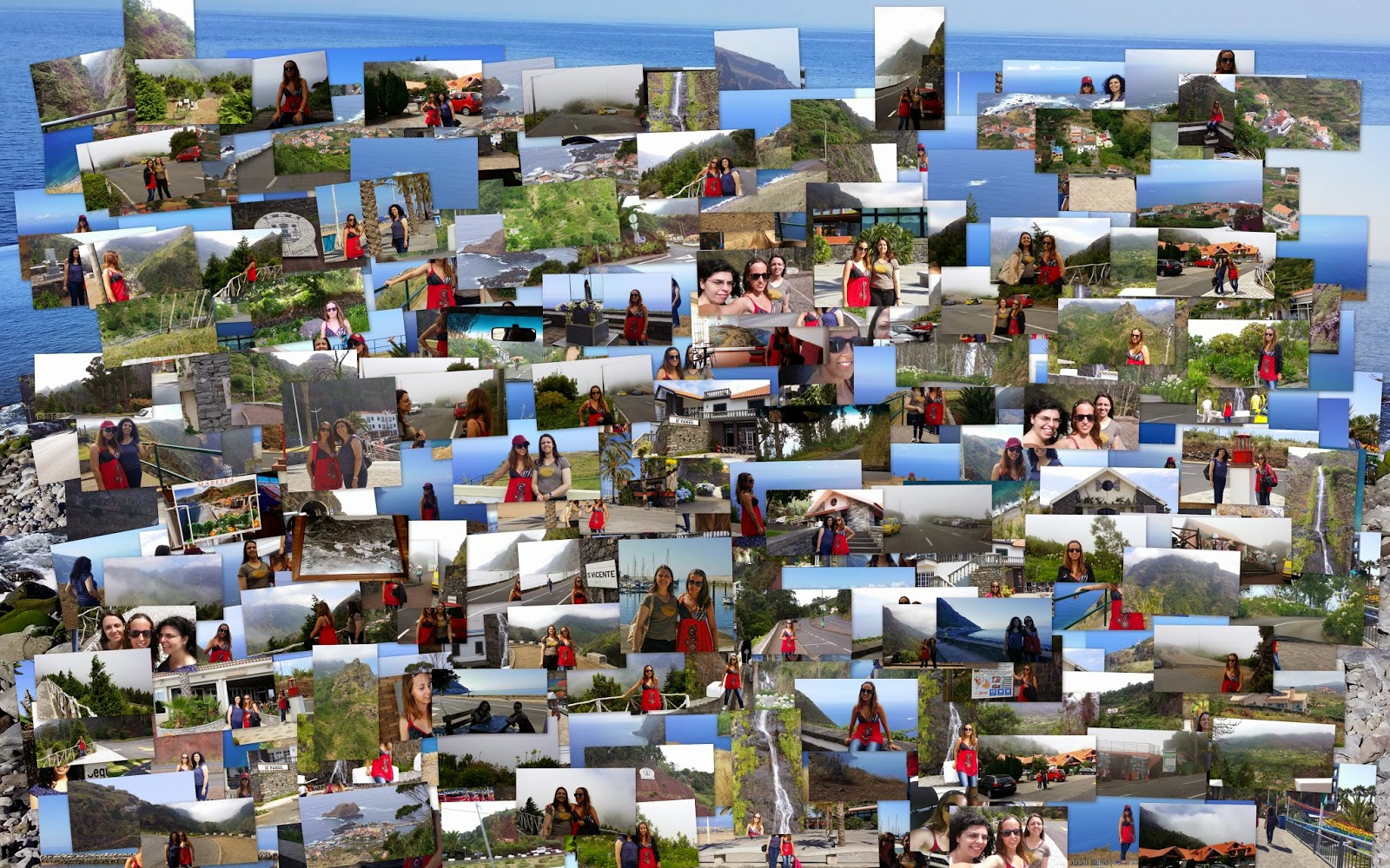
12th July (Saturday)
Having the best time with my friends. This Saturday was great cause I met new marvelous places!!! I took many many photos and I lived one of the most incredible days in Madeira
Having the best time with my friends. This Saturday was great cause I met new marvelous places!!! I took many many photos and I lived one of the most incredible days in Madeira


First stop in Ponta do Sol, the land of the sun

Ponta do Sol (literally ‘Sun Point’), located in the southwestern coast, between Ribeira Brava, to the east, and Calheta, to the west, São Vicente, to the north, and the Atlantic Ocean, to the south, is a peaceful and beautiful village by the sea and – as the name already implies – the sunniest point of the island throughout the year, where you can enjoy an excellent pebble beach and beautiful sunsets. It boasts breathtaking landscapes and encompasses the three parishes Ponta do Sol, Canhas and Madalena do Mar

Extended forests and the high plateau of Paúl da Serra are the highlights to visit in this area. Furthermore the council of Ponta do Sol offers excellent bathing conditions, although you won't find sand here... but a pebbled beach. The major beaches are those from Madalena do Mar, Anjos, Lugar de Baixo and Ponta do Sol. We could say that the strong points of this area are the warm seawater, the low undulation and the excellent sun bathing areas

We were there a little time but enough to take some pictures


The main economic activities of Ponta do Sol reside in the primary sector, where agriculture assumes a prominent place, particularly in terms of sugar cane, banana, horticulture and floriculture production


Ponta do Sol’s climate is mild and not very humid. The temperatures range on average between 29 ºC (84 ºF) in the summer and 18 ºC (65 ºF) in the winter


Coat of arms of Ponta do Sol


Ponta Sol Shopping


The last picture in Ponta do Sol

Pictures from the car

Narrow mountain roads

Second stop: Arco da Calheta. Views from the top of the cliff

Arco da Calheta is a civil parish in the municipality of Calheta

The parish of Arco da Calheta is surrounded to the north and west by the parish of Calheta, and east by the municipality of Ponta do Sol (specifically the parishes of Canhas and Madalena do Mar), fronting the Atlantic Ocean along its southern border


Buildings are found in the amphitheatre-shaped valley, as well as on the escarpments overlooking the community, alongside Calheta (in Calhau Grande) and Madalena do Mar (Achada de Santo Antão)

Its landscape within this semi-circular valley was the basis for its name; the early settlers, owing to the band/arch of settlements with the valley, baptized the region the "Arch of Calheta", or Arco da Calheta


A band of laurisilva forests subdivides the parishes
built-up area from the barren vegetation of the mountains

After the discovery of the island this parish was one of the first to be submitted to huge agricultural explorations, giving origin to extensive lands with noble houses, chapels and cultivated areas

A pebble beach


Third stop: Madalena do Mar, a small village in
the municipality of Ponta do Sol with beautiful sea and cliff views
the municipality of Ponta do Sol with beautiful sea and cliff views

Madalena do Mar is a characteristic fishing village with a beautiful promenade along the pebble beach. It’s location and accompanying climate has helped it to establish the biggest banana plantations on the Island

This place was once overcrowded with camping tents but they have long since disappeared. This beach now boasts a volleyball area, a restaurant/bar, shower facilities and, of course, the lovely beach

This place is also ideal for sunbathing, it offers clean waters
with warm temperatures and an unusually calm sea


Restaurante Cantinho da Madalena in Avenida 1º de Fevereiro N 2


The coastal extent of Madalena do Mar is a strip of cultivated terrace-fields,
with several buildings along the ravine and in the escarpment


Already in Calheta, the most important town
in southwestern Madeira, is known for its warmth and sun filled days
in southwestern Madeira, is known for its warmth and sun filled days


Calheta is one of Madeira's hottest tourist spots
with a beautiful little marina and two man-made golden sandy beaches
with a beautiful little marina and two man-made golden sandy beaches


It’s considered a favorite place, not only by the locals but also by those who visit it. Founded in 1430 Calheta has a large selection of historical churches and it
was one of the first places to be explored by the early colonisers
was one of the first places to be explored by the early colonisers

Selfies


Praia da Calheta is one of the few sandy beaches
of Madeira, with sand imported from North Africa

People bathing in water


Walking down the street Vila da Calheta


Lookall Bar at the Hotel Calheta Beach, next to the beach :-)


The modern 4 star Hotel Calheta Beach

Port of Calheta


Located in the extreme west of the island, this beach was granted the ‘Blue Flag’ confirming excellent water conditions and facilities (changing rooms, lockers, restaurant service, lifeguard service, first aid centre and car park). It's ideal to take a walk along the promenade and the the marina, and experience more closely the beauty of the crystal clear sea :-)

This stretch of sand is backed by a long, palm-lined promenade and has all manner of services to enjoy the sun and sea no matter the season. A nice place to spend the time!


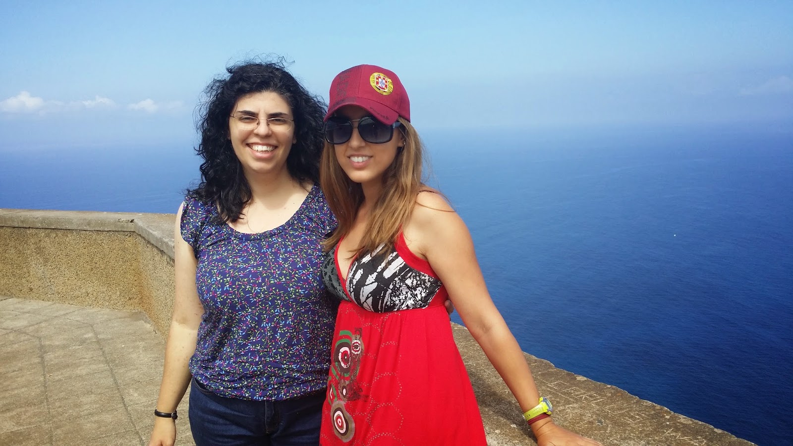
Having fun with my friend Andreia

Micaela and I


The latest photos in Calheta


Looking for our next destination: Ponta do Pargo


Already in Ponta do Pargo. Ponta do Pargo's name came from its location on the extreme coastal west point (Ponta) and for being rich in a species of fish called 'pargo'. Ponta do Pargo is a civil parish in the municipality of Calheta. It's located west of the municipal seat of Calheta, and southwest of the municipality of Porto Moniz

Due to its plane terrain this is a very distinguished area on Madeira Island. Tranquil and peculiar, this parish maintains its charm almost all year round, becoming especially alive when religious festivals occur. Another event that makes it shine is the ‘Apple Festival’ (Festa do Pêro)

PONTA DO PARGO LIGHT HOUSE VIEWPOINT
This viewpoint from the ‘Farol’ (lighthouse) at Ponta do Pargo, in Calheta, is located in the westernmost tip of the island of Madeira. From this viewpoint one can see the sea, between the lighthouse up to the Achadas da Cruz. This lighthouse has existed since 1922 and is at an altitude of 312 meters

Micaela and I :)

This viewpoint offers a view of the vast landscape surrounding the island’s westernmost cape. The Ponta do Pargo Lighthouse viewpoint, located in Ponta Vigia, on the island’s westernmost cape, rises to an elevation of 312 m, offering stunning views of the immense ocean and the rugged landscape, extending from the Ponta do Pargo lighthouse to Achadas da Cruz

This place is captivating for those who love scenic lookouts!

The iconic Ponta do Pargo Lighthouse located at the Ponta do Pargo escarpment

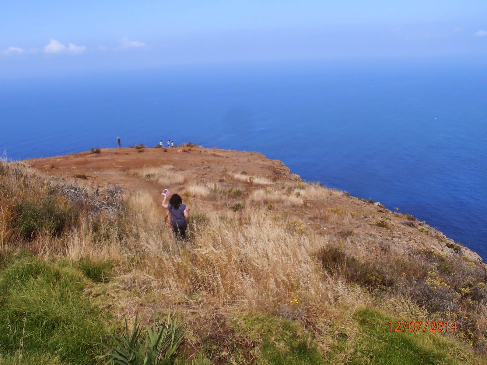
Andreia and I, courageous women, descending and Micaela and their mom waiting for us

Beautiful high cliffs descending to the sea!


Without fear!


The strategically located lighthouse


On the edge of this high cliff!


We were standing on the very edge of this high cliff

We found here two friendly catalan men! One of them took these pics xD


Fascinating landscapes

Selfies on the edge of the cliff.... Chilling moments :P


Micaela taking pictures of us from above


Saying helloooooooooooooo to Micaela while Andreia was taking a picture of me


OMG...I feel more fear seeing the photos than being there xD


Crazy moments xD


Time to climb the escarpment


Again above

Coast of Ponta do Pargo; the cliff-top escarpment

This enchanting village captivates visitors with its intoxicating natural beauty, calming silence and with the most romantic sunset ever!

More pics with Micaela and Andreia


In proximity to the lighthouse and following the signs that say “miradouro” (viewpoint) you will find the bar/restaurant “Teahouse”. “Teahouse” is a small and comfortable place surrounded by a garden with some benches built in rustic wood and a spectacular view over the sea


Amazing


Crystal clear water


The bar/restaurant “Tea House”: Casa de Chá O Fio

Beautiful flowers

A really beautiful place


Front view


Another restaurant: O Farol in Rua do Farol, 3. We stopped for lunch here

Great place to stop of for lunch

Very welcoming atmosphere. Quite a unique quiet
rural spot just a couple of hundred metres from the sea

Ready to eat this delicious lunch


A tradicional restaurant with friendly staff working there.
If you want to try good plates, you must come here!


Beautiful painting on the wall: O Farol (the LightHouse)

At the entrance to the restaurant after eating

A small replica of the lighthouse at Ponta do Pargo


Beautiful house in the fields

Below you can see many pictures taken from the car during the journey


What a trio!


Scenic mountain roads with flowers


Going to the The Santa Viewpoint, in Porto Moniz

This viewpoint lies on the road that follows the charming village of Porto Moniz in the direction of Santa. To access the Santa Viewpoint, just follow the road that spirals up to Santa from Porto Moniz. At the midpoint of this road there is this viewpoint that offers an ideal view of Porto Moniz. This is one of the most

Overlooking the village, this viewpoint has a privileged view over the northern part of Madeira, more properly the fantastic region of Porto Moniz, with its natural pools and the nearby Mole Islet


Enjoying these spectacular views and scenery


Surrounded by bizarre lava rocks, these shallow pools are filled by the tide with crystal clear water and are a favourite bathing venue for the locals


I'm actually beginning to run out of words really to describe the beauty of this island

Beautiful mosaic of the coat of arms of Porto Moniz


In the vicinity of this viewpoint is located the Chapel of St. Madalena
that celebrates in July the festivities in honour of the patron


What a privileged place!


An isolated house in the mountains


Perfect place to take pictures :)


Driving direction to São Vicente

Great roadside views


Before the establishment of the first road network, the route to the north and south slopes was precarious and very winding. Until the first cars appeared and more roads were built, the north coast was very isolated and almost inaccessible to the mortal

Old road from Porto Moniz to São Vicente

According to the writer Raúl Brandão the hardships of the journey to the village of São Vicente were well compensated with dazzling sceneries. However, it was ‘Marquez de Jacome Correa’ who best understood and described it. Encumeada revealed him a valley similar to “the state in which the first navigators found themselves and were surprised in its virginity and its lonesomeness”

Waterfall on the northside of the island near São Vicente


SOOOOOOO BEAUTIFUL


São Vicente is a charming village in the north of the Island set in one of the most beautiful valleys of Madeira. The northern region of Madeira has a rude beauty that impresses - in it dominate aspects from the first ages of the world. It's the freshest area of the island and the most propitious for the emigration of those who like spending the summer at the seaside or in the country


The dazzling vegetation, the waterfalls that made James Yate Johnson call it the "Cascade Valley", the crops, the orange trees, the vineyards, the stone houses and the small chapel stuck on the rocks... Just a wonderful place to be visited by anyone!

Túnel de Água D'Alto (600m)


Only recently opened, a fascinating attraction is the 'Caves of São Vicente'. These caves are actually lava tubes created whilst Madeira was still actively volcanic and extend for many hundreds of meters


Overlooking the valleys of São Vicente, within the World Heritage Site
of the ancient Laurissilva Forests, 2 km from São Vicente


Feiteiras - Serra D'Agua


Our final stop: Encumeada Viewpoint

Located at an elevation of 1.007 m, this viewpoint offers a superb landscape over the north and south coasts of the island and the valleys of Ribeira Brava and São Vicente


A new road traverses the 1004 m high Encumeada pass. Starting in Ribeira Brava at the south coast, the road winds up to Serra d’Água (which was the island’s first water power station) and arrives at the top of the valley giving incredible views of both the south and the north coast


Souvenirs Encumeada: gift shop


The Boca da Encumeada viewpoint rises to and elevation of 1.007 m, on the crest of the ridge that runs through the interior of the island, and offers superb views of the deep valleys of Ribeira Brava (south coast) and São Vicente (north coast)


On many days a fascinating display of clouds arriving from the north
and curling their way down the southern slopes can be observed


Hotel Residencial Encumeada in Feiteiras Serra D'Água, located in the heart of the Laurissilva forest which has been recently recognised by UNESCO as a natural world heritage site, the Residencial Encumeada is situated on one of the most beautiful slopes of the Ribeira Brava valley, at an altitude of 950 metres

Ideal position for walking trips

Selfies


This area is favoured by the beauty of its green landscape and its accessibility to walks along the typical “levadas” which carry the water to irrigate the agricultural land and make the link with other tourist attractions on the island

Among these for example – Pico Ruivo, the highest point of the island, Boca da Corrida, Folhadal, Pináculo and Bica da Cana. At about 42 kms from the international airport of Madeira and 8 kms from the town of Ribeira Brava, the Residencial Encumeada offers the tranquillity of holidays spent close to nature as well as maximum comfort


Restaurante do Residencial Encumeada

Inside the restaurant. Below two images of the same place but different time :)


My favourite ice cream: Magnum White Chocolate :)

Eating our ice creams

Encumeada is a perfect location for hikers

Madeira is ... 100% nature


The place and the scenery was incredible


Madeira is often called 'the floating garden in the Atlantic'


It's time to return home again... It was a wonderful, joyous day!


.jpg)


No comments:
Post a Comment